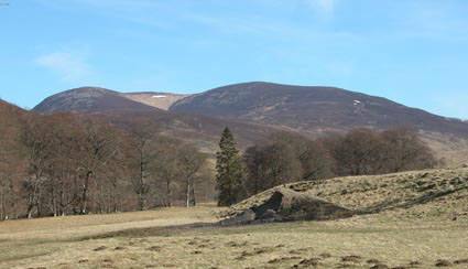
Carn a' Chlamain from Glen Tilt
View up Glen Tilt towards Carn a'Chlamain from near Gilbert's Bridge. The summit is hidden behind the dark hill on the right, which is Braigh Clas Daimh, our route of descent.
Carn a'Chlamain, 963m
|
Date: 10/4/2003 |
Tops and Munros |
|
Companions: Anne |
|
|
Distance: 12km walk + 16 km cycle | |
|
Climbing: 650m walk + 150m cycle | |
|
Time: 5 hours + cycle | |
|
Weather: warm day, with clear blue sky | |
|
Munro Tally: M152, T260 | |
|
Our second foray up Glen Tilt. Following a successful trip, using bikes, to climb Beinn Dearg on the previous day, we were pleased to see a cloudless blue sky after breakfats at our B&B in Pitlochry. Once again, we drove up to the foot of Glen Tilt, and cycled up the glen on a fairly smooth gravel road. It was a lovely cycle run, gradually gaining height, trhough woods, then into more open landscape to the foot of the Allt Craonaidh beyond Marble Lodge. With little efffort, we were 5 miles in, and right at the foot of the mountain. Our route was up the SW ridge, farily steep at first, then easing off, on a well-formed path until we joined a land rover track coming up from the east. FAt the top of the SW ridge, we followed thetrack trhough some rocky terrain, truned west, and after a short steep climb, we reached the top of the summit cone. We decided to complete the circuit of the hill, by descending down the broad grassy west ridge, over some curiously tussocky ground. This courved gently round to the south, before a final steep grassy descent back to the starting point. Finally, a pleasant 5 downhill miles on the bikes (no punctures this time!) back to the car at Old Bridge of Tilt. | |
|
|
Carn a' Chlamain from Glen Tilt View up Glen Tilt towards Carn a'Chlamain from near Gilbert's Bridge. The summit is hidden behind the dark hill on the right, which is Braigh Clas Daimh, our route of descent. | ||||
|
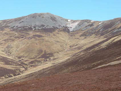
Carn a'Chlamain >>> View of Carn a'Chlamain's scree covered summit above the headwaters of the Allt Craonaidh, as seen from the long SW ridge on our ascent.
|
| ||||
|
|
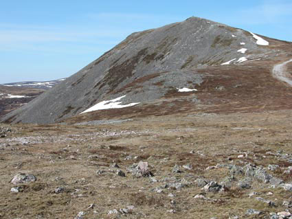
<<< Carn a'Chlamain Approaching the summit cone of Carn a'Chlamain up the landrover track from Forest Lodge. A few small snow patches remain from the winter. | ||||
|
|
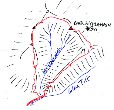
<<<< Plan of day's route | ||||
|
To see a road map of the area around this mountain, click here If you want to see a 1:50000 OS map of the mountain, wait until the road map is displayed by streetmap.co.uk, then click the third "house" from the left on the zoom symbol, which will be displayed below the road map:
|
|
return to Mountains home page |
Comments or questions? david@dbethune.com |